Mapping Intelligence with GIS - GIS_WORLDWIDE - Geospatial Intelligence
Empowering decisions through data, maps, and purpose-driven insight.
Fusing geospatial analysis, field technologies, and storytelling to solve real-world problems.


My Portfolio
Hi there!
Welcome to my portfolio—a curated collection of projects that showcase my skills, process, and impact. Click on any project to see the story behind the work and how I bring ideas to life.


Meeting the cofounder and owner of ESRI—Jack Dangermond

Explaining integration of data in Web-app builder and survey123
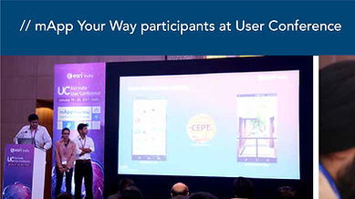
ESRI applications usage demonstration
Award ceremoney at ESRI- USER conference

UC AMBASSADOR award

TA for Civil and Natural resource engineering

University of Canterbury - Masters Graduation

President for Post graduate student association (PGSA)

Working as Micro-credential Administrator

Student MENTOR for UC-student-mentor program

UCISA- Secretary for the undergradute students


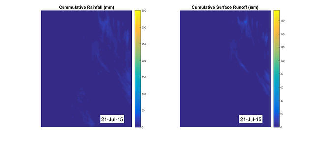

Cumulative rainfall and surface runoff
The variation and changes visible of three different years 2013, 2015 and 2016
Skills
Proficiencies
Data Analysis
Expertise in analyzing spatial data to derive meaningful insights that support decision-making processes.
Mapping
Creating detailed maps for a variety of applications, ensuring clarity and precision in visualization.
Programming
Utilizing programming languages like Python and R for automating data processing and analysis tasks.
Collaboration
Working effectively with cross-functional teams to achieve project goals and deliver successful outcomes.